Open a DXF in QGIS
and keep the drawing
QGIS can add a DXF file. What it gives back is usually not the drawing: everything lands in one layer per geometry type, text lands at the wrong size, dashed lines turn solid, hatches disappear. The free edition of EchoCad keeps the structure instead — and costs nothing, with no converter to install.
Scope, stated up front. The free edition reads DXF. It does not open DWG. If your file is a DWG, either save it as DXF from the CAD you already use — two steps — or use EchoCad Pro, which opens DWG directly. The reading code below is the same in both editions.
Install
- Download
echocad-<version>.zipfrom the releases. - In QGIS: Plugins → Manage and Install Plugins, then Install from ZIP.
- Open Plugins → EchoCad → Import drawing… and pick the DXF.
Listing in the official QGIS plugin repository is in progress. Once it is approved, searching for EchoCad in the Plugin Manager is enough and step 1 goes away. QGIS 3.34 LTR or newer is required; 3.44 and 4.x are checked as well.
What comes across
- One QGIS layer per CAD layer, split by geometry type. A hundred CAD layers become a hundred QGIS layers you can switch off, style and join.
- Entity colour, line type and line width — dashed, dotted and centre lines stay what they were.
- Hatch patterns rebuilt from the drawing’s own definitions, not approximated from a legend.
- Text at its original size, rotation and colour, so the plan still reads as a plan.
- Optional GeoPackage output. Leave it unchecked and the drawing opens as temporary layers.
- Ten interface languages — English, German, Spanish, French, Italian, Japanese, Korean, Polish, Portuguese, Chinese — following your QGIS language.
The same DXF, both ways
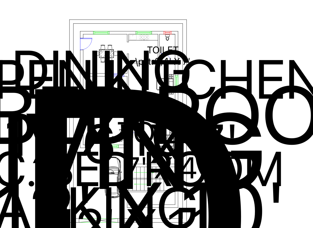
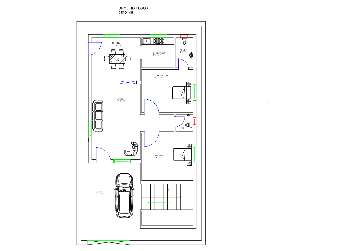
Public sample drawing (floorplan-task1.dxf), not a staged example.
This is what one drawing looks like; it is not a claim that QGIS fails on every file.
In our 50-drawing sample QGIS also opened some drawings cleanly. The difference shows up
on text, hatches and layer structure, and the measurement behind it is in
the docs.
Free and Pro
| Free | Pro | |
|---|---|---|
| DXF — layers, colours, line types, hatches, text | yes | yes |
| DWG, R14 through 2018 and newer | — | yes, converter bundled |
| Drawings per run | one, by hand | a whole folder |
| Block attributes as attribute fields | — | yes |
| Mapping profiles (CAD layers onto your schema) | — | yes |
| Georeferencing from two reference points, Z kept | — | yes |
| Processing toolbox algorithms and CSV report | — | yes |
| Works with no internet at all | yes | yes |
Download the free edition What Pro adds
Questions people actually ask
Does my drawing get uploaded anywhere?
No. There is no account, no phone-home and no cloud step. The import runs in QGIS on your machine, and the free edition needs no network at all — it is a reasonable choice for a closed network.
Why not just use ODA File Converter and the built-in importer?
Converting DWG to DXF is a fine workaround, and the free edition starts exactly there. Two things are left unsolved by it, though: the DXF still arrives as one layer per geometry type, and ODA File Converter itself is a separate install whose licence does not cover commercial use without registration. The DWG page lays out the three options.
Is the source open?
Yes — github.com/EchoPrime-Studio/echocad, GPL-2.0-or-later. Pro is a separate plugin id, so the two install side by side and never overwrite each other.
What if a drawing comes out wrong?
Ask on GitHub Discussions with the drawing’s layer list and a screenshot — the answer then helps the next person too. If you cannot show the drawing in public, write to echoprime.studio@gmail.com. Import failures are tracked against a 50-drawing public sample set, so a report either reproduces or becomes a regression test.
Version 0.1.0 · QGIS 3.34 LTR or newer · Windows and macOS (Linux works if you bring your own converter for Pro).